
Lookout
Karaka Point Historic Reserve
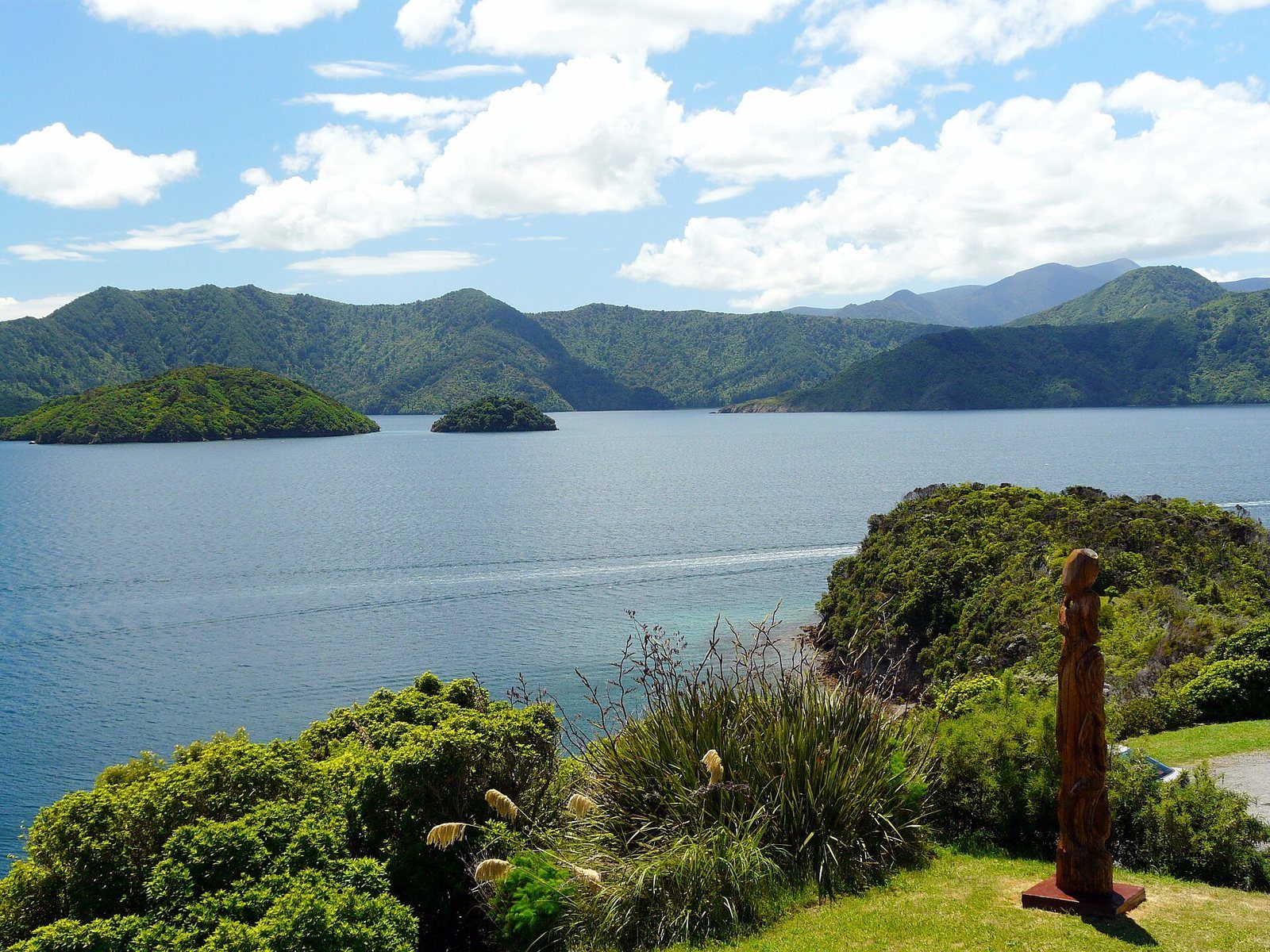
A headland lookout beyond the Snout on the road to Whatamango Bay.
Photo: grumpylumixuser / Wikimedia Commons, CC BY 3.0
A named historic reserve on the headland past Waikawa, on the Port Underwood Road side, with views across the sound. Marked on the council's map; no formal track figures are published.
At a glance
- Cost
- Free
- Getting there
- By road, past Waikawa toward Port Underwood
- Track
- No length, time or grade is published by DOC or the council for a walk here
About Karaka Point Historic Reserve
Karaka Point is a real place with an uncertain amount of documentation: it appears on the council's own Picton map as a historic reserve on the headland beyond the Snout, and photographs from it show the classic view down the sound past a carved pou, but neither DOC nor the council publishes a named walking track for it. Treat it as a lookout to drive to on the way toward Whatamango Bay, and treat any specific walk figures you see elsewhere as unverified.
Know before you go
- No published track data — we have not invented any.
Sources for this page
Location: OpenStreetMap contributors via Nominatim (Karaka Point; feature).
Facts on this page were checked against the sources listed on 5 September 2026.
Something wrong or out of date? Tell us.
Nearby
Straight-line distances from Karaka Point.

Whatamango Bay
A DOC campsite bay 10 km east of Picton on Port Underwood Road — about 15 minutes from the ferry.

The Snout Track
The classic Picton walk: along the headland between the two marinas to a lookout, then on to the point.

Waikawa Bay
The next bay north of Picton, home to Waikawa Marina and the Te Ātiawa community that moved here in 1850.

Picton to Waikawa Track
The easy, dog-friendly walk between Picton and the next bay.
Related
Whatamango Bay
A DOC campsite bay 10 km east of Picton on Port Underwood Road — about 15 minutes from the ferry.
The Snout Track
The classic Picton walk: along the headland between the two marinas to a lookout, then on to the point.
Waikawa Bay
The next bay north of Picton, home to Waikawa Marina and the Te Ātiawa community that moved here in 1850.